Kailash Mansarover Yatra Tour
Link Copied
Duration : 11 Nights / 12 Days
Destination Covered : New Delhi, Almora, Chaukori, Lake Manasarovar
Tour Activities : Religious & Pilgrimage
Price on Request
New Delhi, Almora and Chaukori Tour Itinerary
Day 1
The pilgrims cover 320 Km from Delhi to Kathgodam via Moradabad, Rampur, Haldwani. They cross the rivers Yamuna, Ganga and Ramganga W. rivers on the way. Before starting the journey, pilgrims are briefed by the Under Secretary, Ministry of External Affairs, about the Yatra and their medical check-up is done at Indo-Tibetian Border Police Centre. From New Delhi, you are taken in an air-conditioned coach to Almora, a small town in the foothills of the Himalayas in the Kumaon hills of Uttarakhand. As the Yatris have to leave Delhi in the morning by 0600 hours, please ensure that your baggage is packed and ready by 0500 hours. The journey from Kathgodam to Dharchula is performed by non AC buses. The KMVN will make arrangements of night halt for yatries at its Tourist Rest House, Almora. This is an ideal day for Yatris to get to know each other. For the successful completion of the Yatra it is essential to get to know each Yatri's strengths and weaknesses.
Day 2
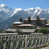
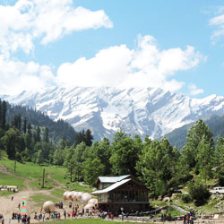
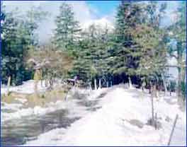
After breakfast at Almora, yatris leave for Kausani enroute Chaukori. The 55 km drive to Kausani traverse through the serpentine roads offering splendid views of mountain peaks and famed flora of Kumaon region of Uttarakhand. After the lunch at Kausani the Yatra proceeds towards the destination of the day, Chaukori, covering a distance of 90 km. The region boasts of unspoilt nature, a land bestowed with natural abundance, fruit orchards, and the jungles of Pines, Oaks and Rhododendrons. Chaukori is a tiny hill station in the Pithoragarh district set among the lofty peaks of the western Himalayan Range. The Mahakali River, running along its eastern boundary, forms the Indo-Nepal international border. Chaukori's elevation is 2010 meters with a spectacular view of the snowy peaks of Nanda Devi and Panchachuli peaks.
Day 3
After early breakfast, yatris leave Chaukori for Dharchula. Enroute, yatris pay obeisance at the Patal Bhubaneswar, a limestone cave temple, 42 km from Chaukori. Legend and folklore have it that this underground cave enshrines Lord Shiva and thirty three crore Gods. The cave is 160 meters long and 90 feet deep from the point of entrance. Limestone rock formations have created various spectacular stalactite and stalagmite figures of various hues and forms. This cave has a narrow tunnel-like opening which leads to a number of caves. The cave is fully electrically illuminated. There is a folklore that the Pandava brothers passed their time here during banishment. It is also believed that this cave is internally connected to the four abodes (Char Dham). The motor able road ends half a kilometer away from the cave entrance. Yatris have to descend nearly 100 steps into this narrow cave, to reach the sanctum sanctorum, which gives an overwhelming feeling that one is entering the centre of the earth.
After Darshan and puja at Patal Bhubaneswar, the Yatra proceeds to Didihat, located at a distance of 52 km, where arrangements for lunch are made. Didihat offers picturesque views of verdant valley surrounded by attractive ridges and a panoramic view of several snow clad Himalayan peaks, including Pachachuli Peaks. Thereafter, yatris head towards the Indo-Tibetan Border Police (ITBP) Camp Headquarters at Merthi, just 6 km away. Yatris are extended a traditional welcome by the locals and the ITBP personnel. A comprehensive briefing on various aspects of the Yatra is conducted by the ITBP.
The town of Dharchula, located on the bank of River Kali, with Nepal just across the river, is the last big town enroute Kailash Mansarovar.
Day 4
On third day 44kms journey from Dharchula to Pangu via Tawaghat by bus and then 13kms trek from Pangu to Sirkha (KMVN Camp) via Narayan Swami Ashram. Trekking starts from Pangu. Coolie arrangements for carrying luggage throughout the further journey (up to Lipu) will be available from here. Pangu lies in Chaudas valley of Dharchula tehsil and is the first village enroute to the Yatra. A fine view of Khela and surroundings is seen from this place. One can also view the Himalayan peaks in Nepal region.
Situated on the Kailash Mansarovar Route Narayan Swami Ashram has been built by Shri Narayan Swami Ji started in the year 1936. It took 10 years to complete the Ashram. All the material for the temple and housing were transported from Almora. 300 to 500 people were engaged in the construction of the temple and the buildings. Swami ji also made schools enlighten and motivated people did lot of social work for the benefit of the tribal and non-tribal people of the area. The vibrations in the environment gives shanti who ever visits the Narayan Ashram (having being the Tapobhoomi of the Rishi Muniies).
Narayan Ashram is known for its picturesque, scenic and the mesmerizing beauty all over the world.
Day 5
Sirkha to Gala is a distance of 16kms. From Sirkha about 2kms the road descends to Samuri (2316mts). A few shops are available in Sirkha. From Samuri steep stony ascent through thick forest to Rungling or Samuriya- Dhar (3048mts) starts. On the top is a heap of stones with flags. Thereafter is a steep descent through a thick forest to the stream Simkhola-gad. From Simkhola gentle upto the village Gala.
Day 6
The day begins with a strenuous 18 km downhill trek to Budhi. On an average, the trek takes about 7 to 12 hours depending on the fitness levels of the Yatris. The most arduous part of the trek is the first 7 to 8 Kms until Lakhanpur. The route down hill is rocky & narrow and must be traversed on foot. Steps have been carved out of the rock here to make the trek somewhat comfortable. After Lakhanpur, the track takes a more or less level course, along the river Kali, which is a very beautiful stretch. Along the way, as the Yatris may have to cross through some waterfalls, raincoats may be kept handy. The village of Lamari is on this route which is a good place to rest and enjoy a hot cup of tea.
From Lamari, the curving trail will take you through Malpa, the site of the tragic landslide of 1998. Here, the rubble still covers a part of the camp.
The last stretch of the trail is across a quaint bridge which brings you into the camp at Budhi. Once you have recouped sufficiently, you may like to visit the old flourmill (Gharat) run on hydel power, which supplies the local village with fine atta.
The day begins with a strenuous 18 km downhill trek to Budhi. On an average, the trek takes about 7 to 12 hours depending on the fitness levels of the Yatris. The most arduous part of the trek is the first 7 to 8 Kms until Lakhanpur. The route down hill is rocky & narrow and must be traversed on foot. Steps have been carved out of the rock here to make the trek somewhat comfortable. After Lakhanpur, the track takes a more or less level course, along the river Kali, which is a very beautiful stretch. Along the way, as the Yatris may have to cross through some waterfalls, raincoats may be kept handy. The village of Lamari is on this route which is a good place to rest and enjoy a hot cup of tea.
From Lamari, the curving trail will take you through Malpa, the site of the tragic landslide of 1998. Here, the rubble still covers a part of the camp.
The last stretch of the trail is across a quaint bridge which brings you into the camp at Budhi. Once you have recouped sufficiently, you may like to visit the old flourmill (Gharat) run on hydel power, which supplies the local village with fine atta.
Day 7
After an overnight stay at Budhi, you will begin one of the most scenic treks on the Indian side of the journey with a steep climb of 5 Kms. Just as you feel the strain, the path levels out and winds its way through the spectacular valley of Chhialekh.
The sights of special importance in the valley include its profusion of rare mountain flowers (like cobra flowers, irises, May apple flower, Kasturi Kamal etc.) and the glacier. You will walk through a beautiful green meadow on your way to Garbyang, also known as the sinking village, with quaint houses having carved doors and newel posts. The approach to Gunji is through a thicket of aromatic trees, which exudes the local incense. You will also have the pleasure of seeing the confluence of the Kali and the Tinker rivers with the Tinker hurtling away into Nepal.
The sights of special importance in the valley include its profusion of rare mountain flowers (like cobra flowers, irises, May apple flower, Kasturi Kamal etc.) and the glacier. You will walk through a beautiful green meadow on your way to Garbyang, also known as the sinking village, with quaint houses having carved doors and newel posts. The approach to Gunji is through a thicket of aromatic trees, which exudes the local incense. You will also have the pleasure of seeing the confluence of the Kali and the Tinker rivers with the Tinker hurtling away into Nepal.
Day 8
At Gunji, there is a two night halt where the ITBP medical team will test you again to gauge your fitness. You will be allowed to continue the pilgrimage only if you clear this test.
Day 9
From this point, the ITBP team, and its doctors, will guide you up to the Tibetan border from where the Chinese authorities will take over. This trek along the Kali is done in stages with ITBP jawans guiding you every step of the way. The route from Gunji climbs higher and elevates in a gradual manner with vegetation changes. One moves along the relatively quieter Kali to walk 10 Km to reach Kalapani (3600m). There are pine, bhojpatra and juniper forests in this region. Although the river has been coming all the way from Lipulekh pass, the small pool formed under a huge rock is considered to be the source of the Kali. As you are closer to Kalapani, you will pass a mountain which has Sage 'Vyasa's cave'. According to Hindu legend, this is the cave where Sage Vyasa performed penance for years. A flag posted by the ITBP is indicative of the entrance to the cave. The ITBP has built a hydel project over the river Kali, which supplies power for the Kalapani camp. At Kalapani Yatris find an emigration checkpoint, where all your documents including passport are verified before you move towards the border.
The stretch from Kalapani to Nabhidhang is an uphill climb. As you move to the upper reaches of the Himalayas, the Kali will be left far below.
The 9-km stretch takes you above the tree line revealing the face of the mountains. During the flowering season, the route itself is like a carpet of flowers in shades of yellow, purple, pink and white. This stretch is subject to brisk winds and it is advisable that you may wear proper clothes and keep your head covered.
It is from the camp at Nabhidhang that you can view the unique phenomenon, of 'Om'. The mountain on the eastern side, Om Parvat, has patterns on the snow, which resemble a naturally formed 'Om', a rare sight since the mountain is usually wreathed in clouds.
The group covers the 9 Km from Kalapani to Navidhang (3987m) surrounded by innumerable wild flowers. This is the region of Musk deer and Monal and the highest stage of Himalayan wilderness. The 'Om Parvat' smiles in front of the pilgrim.
Day 10
This is the last stretch in India before yatris cross over to the Tibetan side. This is a treacherous walk at the best of times and more so if the weather conditions are not propitious at the narrow pass, which is at 16,500 feet. The crossing of the pass is a finely timed affair with the new batch of yatris crossing into Tibet meeting the batch of yatris returning to India after completing the Parikramas.
It is here that the batch has to show a high spirit of cooperation to ensure that each member is able to cross this difficult stretch across ice and snow successfully. ITBP personnel will, of course, be present to render required assistance to yatris. At the Lipulekh Pass yatris will leave India behind and begin their journey into Tibet.
It is here that the batch has to show a high spirit of cooperation to ensure that each member is able to cross this difficult stretch across ice and snow successfully. ITBP personnel will, of course, be present to render required assistance to yatris. At the Lipulekh Pass yatris will leave India behind and begin their journey into Tibet.
Day 11
Taklakot (Purang) is an old trading town. It has several market places, Gompas and Buddhist temples. Yatris will be put up in a guest house with basic facilities. Hot water for bathing will be available for about 2 hours at a time which will be communicated to yatris in advance. Food is also served at set times, duly communicated in advance, and normally includes rice, soup and boiled vegetables provided by the guest house.
Day 12
Yatris will be taken by bus from Taklakot to Darchen, which is the base camp for Kailash Parikrama.
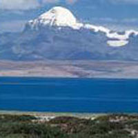
On the way to Darchen, yatris will pass by the Rakshas Tal, a beautiful lake separated by a thin stretch of land from the Lake Mansarovar. This lake, unlike Mansarovar, is not so revered by yatris but is remarkably beautiful in its own way. While Mansarovar is likened to the Sun and Light, Rakshas Tal is compared to the Moon and the Darkness of night. It is believed that Ravana meditated on the shores of Rakshas Tal to seek Shiva's favor. The lake is, therefore, referred to as Ravana Tal. It is from Rakshas Tal that yatris get the first view of the Mount Kailash. An English-speaking Tibetan guide accompanies each batch of yatris during the Parikramas of Mount Kailash and Lake Mansarovar.
Parikrama of Mount Kailash
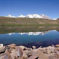
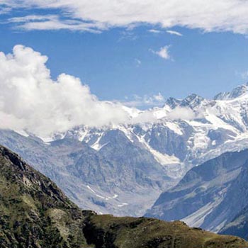
The route goes through a barren landscape, with snow-capped mountains on the horizon. Once the bus crosses the Gurla Pass, at 16,200 feet, the Holy Land spreads out. To the right is the beautiful Lake Mansarover, while Rakshas Tal is to the left.
The Parikrama of Mount Kailash begins from Darchen. Yatris spend the day in the town.
The 48 km Parikrama of Kailash starts from the Barkha Plains, a flat, barren stretch of land. The first leg will take yatris to Deraphuk, 14 km from Darchen. The first 10 km distance is covered by bus/truck. Upon reaching the 'Yamdwar' the proper trek begins. After about 10 km, yatris enter the La Chu Valley or the Valley of the River of the Gods. Along the way, magnificent rock cliffs tower around, with streams and waterfalls flowing from some of them. Some of the rocks have inscriptions of Buddhist mantras on them. The literal meaning of Deraphuk is 'Cave of the Female Yak's Horns'. It provides a magnificent view of Mount Kailash. This is the closest and clearest view that yatris will get of Mount Kailash -a spectacular sight especially when illuminated by the rays of the setting sun. Yatris will spend a night in this camp.
The next day, yatris set off from Deraphuk on a trail which ascends to a 18,600 feet pass, supposed to be guarded by a Tibetan goddess called Dolma. Along the way, a flat stretch strewn with discarded clothing can be seen. This is Shiv Sthal, where Yama, the King of Death is supposed to judge those who cross it. Crossing the Dolma pass remains a test of faith and determination, as blizzards are known to strike without warning. A rock here is said to represent the goddess Tara Devi. Yatris pray to the Goddess with the prayer flags, place pots of butter and light incense sticks.
As yatris descend from the Dolma Pass, they will pass the emerald green Gauri Kund, the lake where goddess Parvati is believed to have bathed. Yatris carry back cans full of water from here.
The steep descent continues through glaciers and paths filled with boulders till yatris reach Zongzerbu. After a night halt there, yatris head back for Darchen, taking a different route, which is mostly on flat terrain.
From Darchen, yatris may, if time permits, pay an optional visit to Ashtapad (the south face of Mount Kailash), which is 5 km away. The route is scenic and the view of Mount Kailash from Ashtapad is breathtaking.
This completes the Parikrama of Mount Kailash.
RETURN JOURNEY
After a two-day stay at Taklakot to complete Immigration and Customs formalities, yatris have to cross back into India via the Lipulekh pass.
The return journey from Lipulekh to Dharchula is via the same route as taken on the onward journey except that from Dharchula, the yatris have to travel to Jageshwar, instead of Kathgodam, and then on to Delhi
More Details about New Delhi, Almora and Chaukori Tour
Inclusions
- Transfers
Payments Terms
- * Some Advance Percentage of total booking amount * Airfare/Transport fare to be paid full at one time in advance.
Cancellation & Refund Policy
- * Upon cancellation, refund will be made after deducting the Retention Amount. * Retention Amount varies as per the number of days left before your package start date.
Fill Enquiry Form Below

